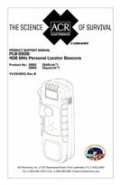

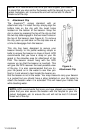
0
Owner's of the ACR Electronics Marine Safety Devices SARLink gave it a score of 0 out of 5. Here's how the scores stacked up:
Y1-03-0241A 18
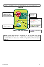
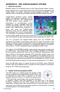
APPENDIX B - THE COSPAS-SARSAT SYSTEM
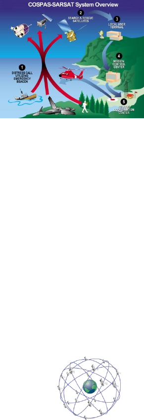
1. General overview
Beacons transmit to the satellite portion of the Cospas-Sarsat system. Cospas-
Sarast satellites are an international system that utilizes Russian Federation and
United States’ low altitude, near-polar orbiting satellites (LEOSAR). These
satellites assist in detecting and locating activated 406 MHz satellite beacons.
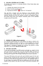
Cospas-Sarsat satellites receive distress
signals from beacons transmitting on the
frequency of 406 MHz. The Cospas-Sarsat
406 MHz beacon signal consists of a
transmission of non-modulated carriers
followed by a digital message format that
provides identification data. The 406 MHz
system uses satellite-borne equipment to
asure and store the Doppler-shifted
frequency along with the beacon’s digital
data message and time of measurement.
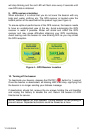
This information is transmitted in real time to
an earth station called the Local User Terminal (LUT), which may be within the
view of the satellite, as well as being stored for later transmission to other LUTs.
The LUT processes the Doppler-shifted signal from the LEOSAR and
determines the location of the beacon, then the LUT relays the position of the
distress to a Mission Control Center (MCC) where the distress alert and location
information is immediately forwarded to an appropriate Rescue Coordination
Center (RCC). The RCC dispatches Search and Rescue (SAR) forces.
The addition of the GEOSAR satellite system greatly improves the reaction time
for a SAR event. This satellite system has no Doppler capabilities at 406 MHz,
but will relay the distress alert to any of the LUT stations. When there is GPS
data included in the distress message, SAR authorities instantly know your
location to within 110 yards (100 m). This speeds up the reaction time by not
having to wait for one of the LEOSAR satellite to pass overhead. Because most
of the search and rescue forces presently are not equipped to home in on the
406 MHz Satellite beacons signal, homing must be accomplished at 121.5 MHz.
Once the 406 MHz signal is relayed through the LEOSAR and/or GEOSAR
network, SAR forces determine who is closest, and then proceed to the beacon
using the 121.5 MHz homing frequency.
2. Global Positioning System (GPS)
The GPS system is a satellite group that enables a GPS
receiver to determine its exact position to within 30 m (100
ft.) anywhere on earth. With a minimum of 24 GPS
satellites orbiting the earth at an altitude of approximately
11,000 miles they provide users with accurate information
on position, velocity, and time anywhere in the world and in all weather
conditions. Beacons that have GPS engines add this data to its distress
transmission, allowing search and rescue forces to narrow the search to a very
small area, thus minimizing the resources required, and dramatically increasing
the effectiveness of the overall operation.


Find Your Products By Category
- TV and Video
- Communications
- Personal Care
- Portable Media
- Computer Equipment
- Home Audio
- Household Appliance
- Car Audio and Video
- Kitchen Appliance
- Fitness & Sports
- Musical Instruments & Equipment
- Power Tools
- Marine Equipment
- Lawn and Garden
- Automotive
- Photography
- Video Game
- Laundry Appliance
- Outdoor Cooking
- Baby
- Cell Phone
Please Login
